Forsyth County commissioners responded favorably to a presentation of the Coal Mountain Overlay, a draft of which was completed in early March.
Coal Mountain Overlay headed to public hearings
Commissioners approve updated draft
External Link
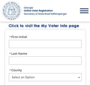 To view your sample ballot click the image above and enter your
voter information.
To view your sample ballot click the image above and enter your
voter information.